Thunder Information
This website provides "Thunder Information" based on observation data from the lightning observation equipment (lightning strike location system) of Kansai Transmission and Distribution.
The lightning strike location system measures the location of thunderclouds and the intensity of lightning strikes by detecting electromagnetic waves generated during lightning strikes and cloud discharges using sensors installed in our supply areas.
The “Thunder Information” page is only available in Japanese.
We regret the inconvenience and ask you to please use the explanation below when viewing the page.
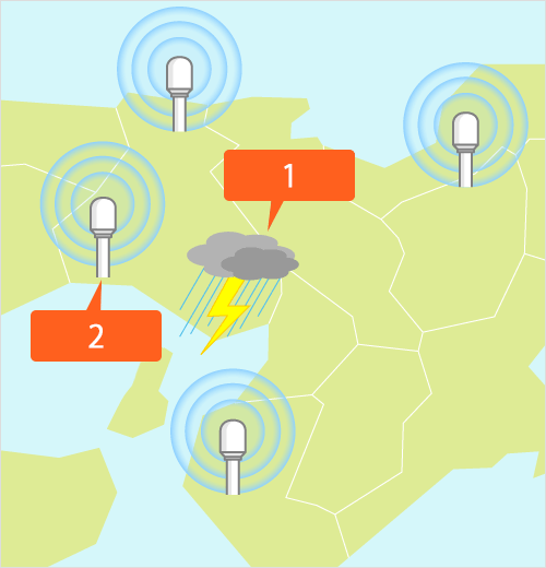
Explanation of Lightning Map
- 1 Lightning strike / thundercloud (discharge) has occurred
- 2 Measurements using data from various sensors
Lightning Map
Thunder Information
The Thunder Information page shows a map with location information on lightning strikes and thundercloud activity in the Kansai region.
The information is automatically updated every 5 minutes or manually as required, so it will reflect the actual situation at the current time.
The map also allows backtracking to view data from up to 6 hours earlier.
Current information, observation data from 10 minutes before, observation data from 30 minutes before, observation data from 1 hour before, observation data from 3 hours before, observation data from 6 hours before
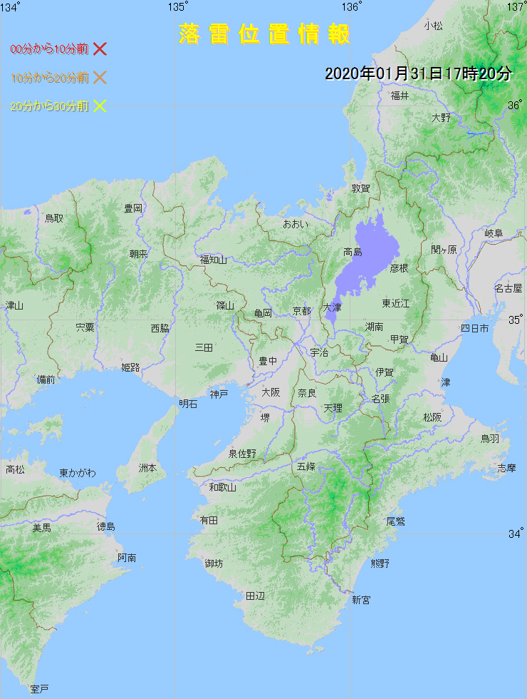
Lightning strike location information
On the map, based on the viewing time, lightning strike information is indicated as follows.
0 to 10 minutes before:
10 to 20 minutes before:
20 to 30 minutes before:
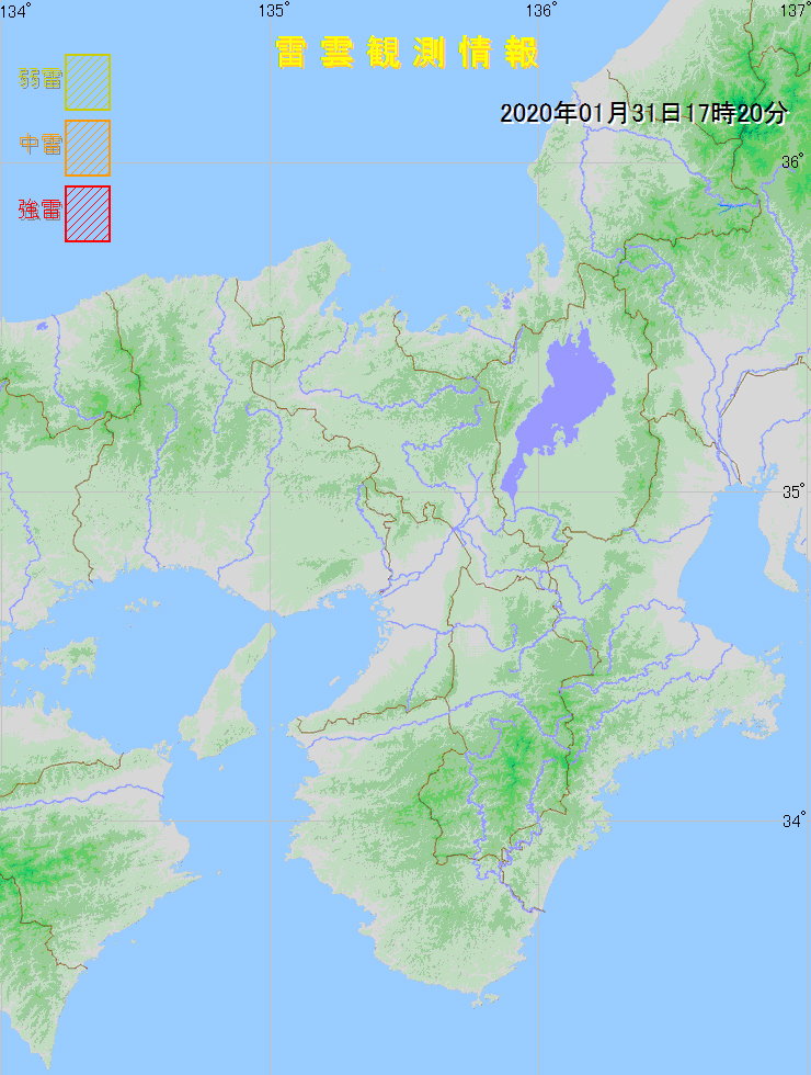
Lightning strike location information
On the map, based on the viewing time, lightning strike information is indicated as follows.
Weak lightning:
Medium lightning:
Strong lightning:
Lightning Strike Related Information
-
Lightning Strike CountermeasuresExplains countermeasures against a lightning strike.
-
Effect of Lightning on ElectricityExplains what happens when lightning strikes a transmission line, and which measures are taken to reduce adverse effects.
-
Frequently Asked QuestionsThis page includes answers to frequently asked questions related to lightning.